Smart ArcGIS CAD Entity Import
While ArcGIS is the most productive, coolest, and just plain swoopiest mapping application on the planet, there are still users who create map products in AutoCAD or Microstation. And there probably always will be.
Given this reality, there also need to be convenient ways to move entities from CAD formats into ArcGIS feature classes. And of course there are. You can simply add a CAD drawing as a layer to your ArcMap document, select a set of entities and paste them into your target feature class. This works great. Just Iike that!
However, there are also occasions when you may need to deal with a larger set of data and in a more rigorous way. That’s what this post describes – a brief introduction to the CADConverter Import Tool.
Quick Demo
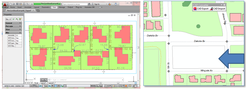
Let’s just jump into what this tool does. Say we’ve just received a plat for a new subdivision from a developer from which we need to import some layers into target feature classes in our Geodatabase. And while we’d like it to be the case that the developer follows our standard layer naming convention, well, in practice that doesn’t always happen. So the first thing we do is open our import tool and scan the drawing for layers actually present.
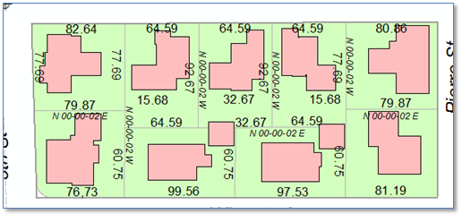
While there is a lot of stuff in the drawing, what we’re looking for are layers with parcel boundaries and building footprints. On the right we see a portion of our Geodatabase where this block is undeveloped.
Opening the “Import AutoCAD Entities” tool we can select the CAD file and perform a quick scan of the layers and entity types and get a count of each.
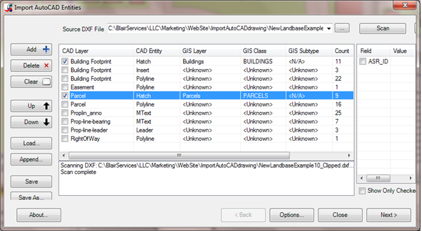
Given that all we’re looking for at this time are parcel polygons and building footprints out selection is easy. After checking those source layers and selecting the target classes we click “Next >” and then click “Import”. Voila! The features are imported.
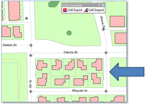
Looking at the map, the parcel and building footprint geometries from the CAD drawing were used to create corresponding features in our Geodatabase.
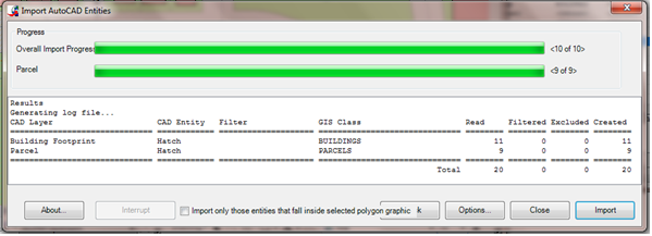
The import occurs within a single edit operation, so we can undo if we don’t like the results… or save them if we do. And if we wanted to include the drawing text, we could do that, too.
Summary
To see more of what the CAD Import tool can do for you, take a look at the Tools page.